Details

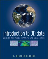
Introduction to 3D Data
Modeling with ArcGIS 3D Analyst and Google Earth1. Aufl.
|
74,99 € |
|
| Verlag: | Wiley |
| Format: | |
| Veröffentl.: | 17.12.2010 |
| ISBN/EAN: | 9781118059869 |
| Sprache: | englisch |
| Anzahl Seiten: | 360 |
DRM-geschütztes eBook, Sie benötigen z.B. Adobe Digital Editions und eine Adobe ID zum Lesen.
Beschreibungen
<b>Render three-dimensional data and maps with ease.</b> <p>Written as a self-study workbook, <i>Introduction to 3D Data</i> demystifies the sometimes confusing controls and procedures required for 3D modeling using software packages such as ArcGIS 3D Analyst and Google Earth. </p> <p>Going beyond the manual that comes with the software, this profusely illustrated guide explains how to use ESRI’s ArcGIS 3D Analyst to model and analyze three-dimensional geographical surfaces, create 3D data, and produce displays ranging from topographically realistic maps to 3D scenes and spherical earth-like views. The engagingly user-friendly instruction:</p> <p>• Walks you through basic concepts of 3D data, progressing to more advanced techniques such as calculating surface area and volume</p> <p>• Introduces you to two major software packages: ArcGIS 3D Analyst (including ArcScene and ArcGlobe) and Google Earth</p> <p>• Reinforces your understanding through in-depth discussions with over thirty hands-on exercises and tutorial datasets on the support website at www.wiley/college/kennedy</p> <p>• Helps you apply the theory with real-world applications</p> <p>Whether you’re a student or professional in geology, landscape architecture, transportation system planning, hydrology, or a related field, <i>Introduction to 3D Data</i> will quickly turn you into a power user of 3D GIS. </p>
Preface. <p>Acknowledgments.</p> <p><b>CHAPTER 1</b> <b>Introduction to 3D Data: Modeling with ArcGIS 3D Analyst and Google Earth.</b></p> <p>Exercise 1-1: Preview Data in ArcCatalog.</p> <p>Exercise 1-2: Create a Layer File in ArcCatalog.</p> <p><b>CHAPTER 2</b> <b>3D Display in ArcScene.</b></p> <p>Exercise 2-1: Set Background Color and Illumination in ArcScene.</p> <p>Exercise 2-2: Set Vertical Exaggeration in ArcScene.</p> <p>Exercise 2-3: Apply a Coordinate System to a Scene.</p> <p>Exercise 2-4: Set 3D Layer Properties for an Elevation Raster.</p> <p>Exercise 2-5: Set 3D Layer Properties for a Raster Image.</p> <p>Exercise 2-6: Set Base Heights for a 2D Vector Layer.</p> <p>Exercise 2-7: Extrude 2D Vector Features.</p> <p>Challenge Exercise: View Regional Park Study Data in ArcScene.</p> <p><b>CHAPTER 3</b> <b>3D Navigation and Animation.</b></p> <p>Exercise 3-1: Set Targets and Observers.</p> <p>Exercise 3-2: Animated Rotation and the Viewer Manager.</p> <p>Exercise 3-3: The Fly Tool.</p> <p>Exercise 3-4: Create 3D Animated Films.</p> <p><b>CHAPTER 4</b> <b>ArcGlobe.</b></p> <p>Exercise 4-1: Understanding ArcGlobe.</p> <p>Exercise 4-2: Explore ArcGlobe’s Options, Add Data, and Redefine Layer Types.</p> <p><b>CHAPTER 5</b> <b>Google Earth.</b></p> <p>Exercise 5-1: Navigating Google Earth’s Interface, and the Planet.</p> <p>Exercise 5-2: Create a Polygon and Edit Its Properties Through Google Earth’s Form Menus.</p> <p>Exercise 5-3: Edit the Gardens Polygon Using KML.</p> <p><b>CHAPTER 6</b> <b>Raster Surface Models.</b></p> <p>Exercise 6-1: Interpolate a Terrain Surface with Spline.</p> <p>Exercise 6-2: Interpolate Terrain with Inverse Distance Weighted and Natural Neighbors.</p> <p>Exercise 6-3: Calculate Hillshade and Aspect.</p> <p>Exercise 6-4: Calculate Slope.</p> <p>Exercise 6-5: Calculate Viewshed.</p> <p>Challenge Exercise: Calculate Viewshed and Slope Levels for Elk Park.</p> <p><b>CHAPTER 7</b> <b>TIN Surface Models.</b></p> <p>Exercise 7-1: Create a TIN from Vector Features.</p> <p>Exercise 7-2: Add Polygon Attribute Values to a TIN.</p> <p>Exercise 7-3: Change TIN Symbology and Classification.</p> <p>Challenge Exercise: Create a TIN of Elk Park.</p> <p><b>CHAPTER 8</b> <b>Terrain Surface Models.</b></p> <p>Exercise 8-1: Create a Terrain Dataset.</p> <p>Exercise 8-2: Rasterize a Terrain Dataset and View it in ArcGlobe.</p> <p><b>CHAPTER 9</b> <b>3D Features and More Surface Analysis Techniques.</b></p> <p>Exercise 9-1: Convert 2D Features to 3D, and Digitize 3D Features in ArcMap.</p> <p>Exercise 9-2: Draw a Line of Sight and a Cross-section Profile Graph.</p> <p>Exercise 9-3: Calculate Surface Area and Volume on a TIN.</p> <p>Challenge Exercise: Create Multipatch 3D Features.</p> <p><b>CHAPTER 10</b> <b>SKP to Multipatch to KML: Finalize the Elk Park Project.</b></p> <p>Exercise 10-1: Convert a SketchUp File to a Multipatch Feature Class.</p> <p>Exercise 10-2: View the Multipatch Feature Class in ArcGlobe.</p> <p>Exercise 10-3: Export Layers from ArcMap to KML, and View Them in Google Earth.</p> <p>About the Tutorial Data.</p> <p>Index.</p>
<p>“With Introduction to 3D Data: Modeling with ArcGIS 3D Analyst and Google Earth the reader will master the craft of 3D visualization, especially if the book is complemented by a theoretical GIS compendium.” (<i>Photogrammetric Engineering and Remote Sensing,</i> 1 May 2012)</p> <p> </p>
<b>K. Heather Kennedy</b> is a GIS Planner in the Community Development Department of Contra Costa County, California. A freelance technical writer, she has written <i>The ESRI Press Dictionary of GIS Terminology and Data in Three Dimensions</i>.
<b>render three-dimensional data and maps with ease</b> <p>Written as a self-study workbook, <i>Introduction to 3D Data</i> demystifies the sometimes confusing controls and procedures required for 3D modeling using software packages such as ArcGIS 3D Analyst and Google Earth.</p> <p>Going beyond the manual that comes with the software, this profusely illustrated guide explains how to use ESRI's ArcGIS 3D Analyst to model and analyze three-dimensional geographical surfaces, create 3D data, and produce displays ranging from topographically realistic maps to 3D scenes and spherical earth-like views. The engagingly user-friendly instruction:</p> <ul> <li>Walks you through basic concepts of 3D data, progressing to more advanced techniques such as calculating surface area and volume</li> <li>Introduces you to two major software packages: ArcGIS 3D Analyst (including ArcScene and ArcGlobe) and Google Earth</li> <li>Reinforces your understanding through in-depth discussions with over thirty hands-on exercises and tutorial datasets provided at www.wiley.com/college/kennedy</li> <li>Helps you apply the theory with real-world applications</li> </ul> <p>Whether you're a student or professional in geology, landscape architecture, transportation system planning, hydrology, or a related field, <i>Introduction to 3D Data</i> will quickly turn you into a power user of 3D GIS.</p>


